Trimble announced the released of the ZX5 Multirotor Unmanned Aircraft System (UAS), a new aerial imaging and workflow solution that captures and processes geo-referenced photo and video data for mapping, agriculture and inspection applications. The Trimble ZX5 complements the UAS portfolio with the ability to reach smaller, remote environments faster, while providing accurate mapping data for improved productivity in the field and back office.
"Unmanned aerial systems are powerful tools that are transforming geospatial-based mapping and inspection applications to positively impact our world," said Todd Steiner, product marketing director in Trimble's Geospatial Division. "Adding a multirotor solution to our portfolio provides options for our customers working across multiple environments to collect accurate spatial data, transform it to intelligence and create deliverables."
With the ZX5, Trimble extends its unmanned aerial portfolio to include both fixed-wing and multirotor solutions, providing customers with a choice to meet their specific requirements. Trimble's fixed-wing UX5 provides longer flight capabilities for large, open environments including farms, mines, canals, flood areas and forests - while the ZX5 is more suited for mapping smaller sites, including facades, obstructed areas, construction sites and standard aerial mapping applications.
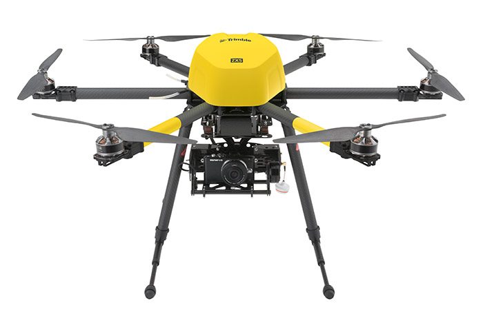
The ZX5 Multirotor is built for everyday jobs where image capture from tight spaces is common. Its vertical takeoff and landing capabilities allow users to work in tight places and obstructed environments where fixed-wing solutions are less suitable. It requires no launcher, is easy to assemble and includes everything needed to capture high-quality geo-referenced photos for aerial mapping and inspection applications.
The ZX5 includes a 16 megapixel camera to capture high-quality aerial imagery, down to 1 mm ground sample distance. The ZX5 also can be equipped to capture live video imagery for civil infrastructure, utility and oil and gas pipeline inspections.
Data captured by the ZX5 can be imported into Trimble Business Center Photogrammetry Module software to create detailed ortho-photos, digital elevation models, point clouds, volume calculations and 3D models, all without requiring specialized photogrammetry knowledge or experience. It also integrates with Trimble's state-of-the-art Inpho UASMaster module for advanced photogrammetric processing.
In addition, the Trimble ZX5 has been granted a Section 333 exemption from the Federal Aviation Administration (FAA).
Training Partner
Trimble also selected Juniper Unmanned as an official training services provider for Trimble's UAS products. In this role, Juniper will provide classroom and field training for Trimble UAS customers worldwide.
Availability
The ZX5 is available now through Trimble's Geospatial Distribution Channel. To learn more about Trimble's portfolio of unmanned aerial solutions, visit: http://uas.trimble.com


Post a comment
Report Abusive Comment