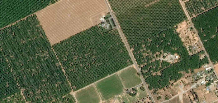
HERNDON, Va. & INDIANAPOLIS — Automated crop intelligence company Intelinair and aerospace company Airbus announced on Feb. 23 a multi-year collaboration agreement that will provide high-resolution Airbus satellite imagery as an input to Intelinair’s artificial intelligence (AI) powered crop analytics AGMRI platform to deliver a complete view of every acre in every field from planting to harvest.
High-resolution imagery services from the Pléiades and SPOT 6/7 satellites will provide 50cm and 1.5m geospatial imagery into the AGMRI platform as an additional input, so that farmers and ag retailers can make data-driven decisions and proactively manage their operations with confidence.
“We are very pleased to be providing high-resolution imagery from Pléiades and SPOT 6/7 satellites, whose complementarity makes them the ideal assets for enriched crop management. They deliver fresh information along with historical insights to help drive decisions in the field. Our data along with powerful machine learning and computer vision from Intelinair will help improve crop yields,” said François Lombard, director of the intelligence business at Airbus Defense and Space.
With satellite and other aerial imagery sources, farmers receive a new perspective of the agronomic conditions in the form of emergence, plant health, weed detection and harvest readiness in their fields throughout the growing season. From this perspective, product performance and crop damage issues become visible so timely management decisions can be made to protect yields and optimize financial returns.
“We are excited to extend our collaboration with Airbus for the next 3 years,” said Tim Hassinger, CEO and president of Intelinair. “Airbus’ high-resolution satellite imagery provides another technology to pair with our analytics platform, AGMRI, so that farmers are able to identify issues in their fields before they become a problem. The use of satellites also will provide the ability to serve growers and ag retail channel partners on a global scale.”
Related Content
Airbus Defense and Space Makes Satellites Available for Precision Farming in the U.S.
Airbus Partners with The Climate Corp. for Satellite Imagery
IntelinAir's AgMRI Captures 'To the Plant' Imagery
[Video] Intelinair Discusses their AgMRI Agronomy Program for Farmers and Service Providers

![[Technology Corner] Farmers Gain Trust in Autonomy with PTx OutRun Retrofit Kit](https://www.precisionfarmingdealer.com/ext/resources/2026/07/09/Farmers-Gain-Trust-in-Autonomy-with-PTx-OutRun-Retrofit-Kit.webp?height=290&t=1783695127&width=400)

