Just in time for corn and soybean emergence in the U.S., DroneDeploy has unveiled two new tools for customers to get a better reading on plant count and stand establishment.
Stand Analysis
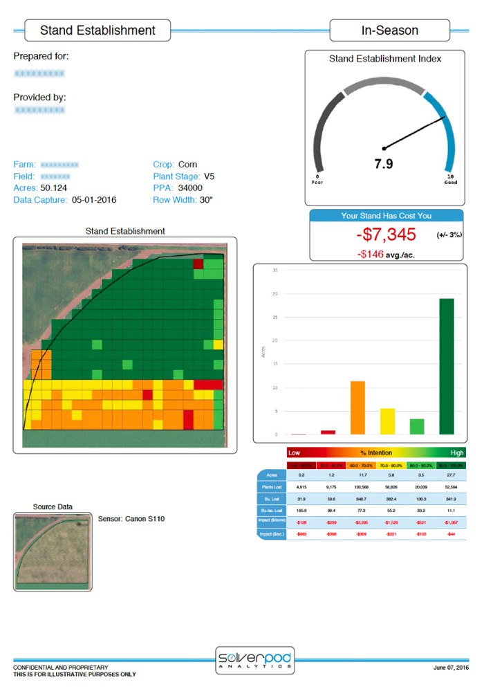
Rather than evaluating stand establishment by painstaking on-the-ground sampling that only gives you a partial picture of what’s going on in your field, the new tool from Aglytix allows you to get an accurate classification of your entire field. Aglytix is an Ag-focused analytics-on-demand company based in Mankato, Minnesota. Their analytical Solver takes your DroneDeploy map of emergent corn or soybeans and creates a shapefile and report that details crop emergence throughout the field.
The analysis calculates the economic loss on the field and offers the opportunity to take preventive or corrective actions to mitigate seed emergence issues. Output includes detailed stand gap mapping, a PDF report highlighting the economic impact, and a zoned shapefile that you can use to make better decisions about where to where to apply inputs.
The sample report (below) highlights loss of emergence on an irrigated corn field showing a zone where a different hybrid was planted with unsatisfactory results. This field had a $7,000 loss of emergence due to poor hybrid placement which will enable the grower to both make better decisions in next year’s planting and better apply nutrients to where they are best utilized during the current growing season.
A Faster Way to Count Crops
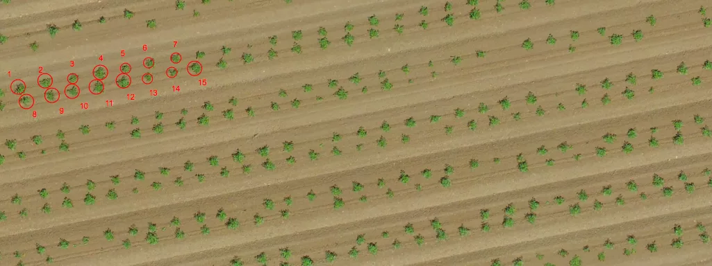
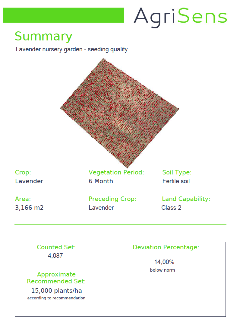
The second tool comes to us from a Serbia-based agriculture tech company called AgriSens that’s combining aerial imagery with computer vision to help growers count individual plants. Where the Aglytix tool focuses on commodity crops like corn and soy, this AgriSens tool shines with seasonal row crops (e.g., tomato, sunflower, potato), in early growing stages and in perennial plantations throughout the year.
The tool leverages your DroneDeploy map to provide accurate information and early insights into the quality of sowing and plant growth for seasonal crops and can also be used to help you manage and keep track of plant count in perennial plantations. It counts individual plants on the mapped area and outputs a report with the plant count and other seeding details.
DroneDeploy user Toshiro Aoki, an agronomist with a private farm in Northern California, tried the plant count tool after several hundred thousand young tomato plants were transplanted and started failing. Read Toshiro’s story.
How to Get Started
Both of these tools are available to all DroneDeploy paid customers and can be accessed directly from the DroneDeploy dashboard. To successfully use these tools, please make sure that your map meets the following imagery requirements:
- At least 2.5 cm/pixel resolution
- Individual plants are visible in the map

![[Technology Corner] Farmers Gain Trust in Autonomy with PTx OutRun Retrofit Kit](https://www.precisionfarmingdealer.com/ext/resources/2026/07/09/Farmers-Gain-Trust-in-Autonomy-with-PTx-OutRun-Retrofit-Kit.webp?height=290&t=1783695127&width=400)

