senseFly – senseFly eBee X
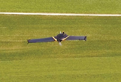
Tech Specs: The senseFly eBee X has been designed to boost the quality and efficiency of geospatial data collection. The platform has a flight time of 90 minutes and features a built-in High-Precision on Demand (RTK/PPK) function to help achieve absolute accuracy down to 1.2 inches without ground control points. The system is compatible with the Parrot Sequoia+ multispectral camera, which features four multispectral sensors to capture visible and non-visible spectral bands as well as an RGB and sunshine sensor. The drone can also be used with the MicaSense RedEdge-MX sensor, a multispectral camera for advanced agricultural analysis.

With a flight time of up to 90 minutes, the eBee X can achieve vast single-flight coverage of up to 1,235 acres at 400 feet elevation and is ideal for mapping large farm sites. It also features built-in steep landing technology, live air traffic data and eMotion flight planning software.
BACK TO 5TH ANNUAL ESSENTIAL GUIDE TO PRECISION FARMING TOOLS

![[Technology Corner] Using Sensors to Measure Impact of ‘Soil Health Management’ Systems](https://www.precisionfarmingdealer.com/ext/resources/2026/07/24/Using-Sensors-to-Measure-Impact-of-Soil-Health-Management-Systems.webp?height=290&t=1784914811&width=400)

