Back to Essential Guide to Precision Farming Tools
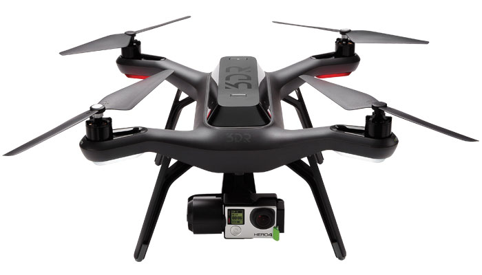
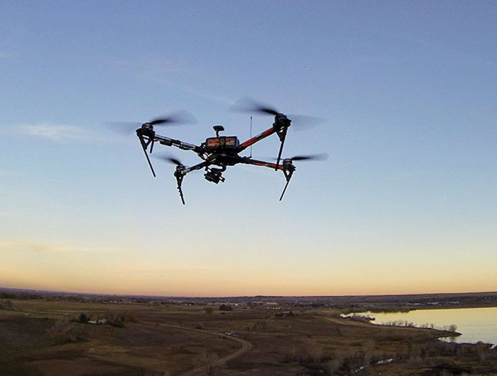
Solo UAV
Tech Specs: The Solo AGCO edition unmanned aerial vehicle (UAV) utilizes intuitive mission planning and cloud-based, high-resolution mapping software. The system provides operators with hardware, software, service and support all in one package. It can fly in up to 25 mph winds and has a max speed of 55 mph. Each fully charged, smart battery is capable of covering up to 60 acres, depending on conditions and user-defined settings, with an average flight time of 20 minutes, fully equipped. The kit comes with four batteries, providing the ability to scout up to 240 acres in one trip. The UAV is equipped with auto takeoff and landing, as well as emergency in-air brake and return-to-home features. It also includes in-app training and configurable settings in order to accommodate varying operator skill levels. The kit includes two cameras, customized for aerial imaging — an RGB camera for color imaging and a near-infrared camera for monitoring photosynthetic activity, or plant health. These cameras, paired with the included one year of Agribotix imaging software, produce high-resolution Orthomosaics, Normalized Difference Vegetation Index (NDVI) and field health and management zone maps to provide farmers insight into their fields and help them find potential yield-limiting problems early.

WOW Factor: It’s built on 3D Robotics Solo platform and utilizes a three-axis Solo Gimbal, accessory bay and swappable motor pods, allowing for easy integration of future technology and features. Image processing history — maintained in the cloud — allows for comprehensive field condition comparison. Live flight data — including the battery life, altitude and distance from home — are all streamed to the operator’s controller for real-time flight control.
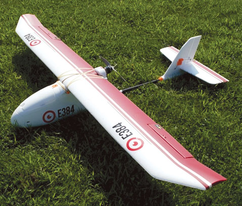
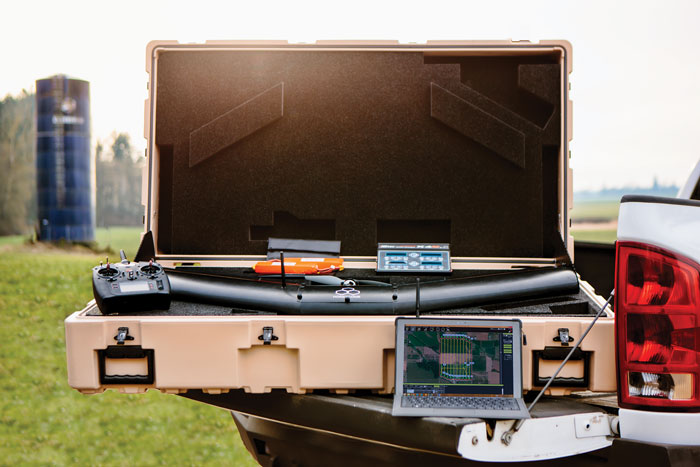
E384 Fixed Wing Drone
Tech Specs: The E384 from Event38 is a versatile drone commonly used for agriculture, surveying, environmental surveys and mining. It can fly 1,000 acres in a single flight with resolution at the 2 cm level. One of Event38’s customers was one of the very first to receive FAA approval through its “333 exemption” process to use our unmanned aerial vehicle commercially for agriculture purposes. Our drones fly completely autonomously from takeoff to landing with our “Easy Button” software.
WOW Factor: Proven in thousands of hours of flight in hundreds of applications to be reliable, safe and economical to use. It can fly 1,000 acres in 100 minutes at 5 cm resolution completely autonomously at a cost of pennies per acre.
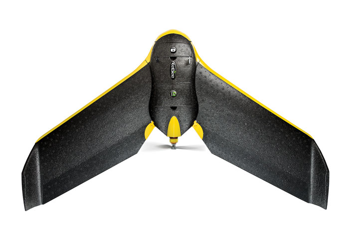
eBee Ag
Tech Specs: With its full drone-to-tractor workflow users can scout crops, analyze plant health, create prescriptions and begin treatment all on the same day with the SenseFly eBee Ag unmanned aerial vehicle (UAV). The system includes eMotion software for flight planning and monitoring, Postflight Terra 3D for transforming the drone’s images into index maps and exportable prescriptions, plus a sturdy carry case. The UAV is a fully automatic drone. Just select the area to map, throw the UAV into the air, and it flies, acquires images and lands itself. With its four different camera options UAV suits numerous agricultural applications. Use the NIR camera supplied or add one of our red-edge, RGB or multispectral sensors. The artificial intelligence and robust lightweight construction ensure it will survive numerous flights (and landings).
WOW Factor: Offers a full drone-to-tractor workflow. After flying, Postflight Terra 3D can generate quick NDVI maps of crops, identify problem areas, create application maps and export prescriptions, all on the same day. These output prescriptions are fully compatible with leading precision farming software and equipment, plus with the system, business data remains confidential — no uploading data to the cloud is required.

Aerial Flight Services
Tech Specs: 3D Aerial has extensive flight experience in both fixed wing and rotary wing unmanned aircraft systems (UAS). They provide flight crews that possess the required private pilot and airman medical certifications. 3D Aerial was granted one of the first 333 exemptions in the U.S. and received a blanket Certificate of Authorization (COA) by the FAA. Their senseFly eBee aircraft are registered for commercial operations in the U.S. and ready to fly. They are authorized to provide aerial imaging services in the precision agriculture domain.
WOW Factor: Services include crop counting and biomass, crop growth/health monitoring, drainage evaluation, yield estimation, weed detection, invasive species studies, plant stress assessment and erosion evaluations.
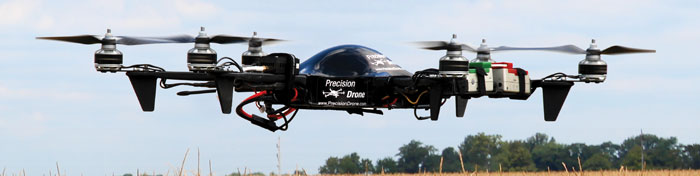
Pacesetter 2
Tech Specs: The PrecisionDrone Pacesetter 2 allows the grower to fly, process and scout up to 160 acres an hour from the field. No sending off imagery and no going back to the office for processing. The integration of One Touch software allows for simplistic image creation and real time management decisions.
WOW Factor: Find problem areas in the field and see the significance of the problem. Utilizing this technology will allow the customer to be proactive on the farm rather than reactive in decision making.
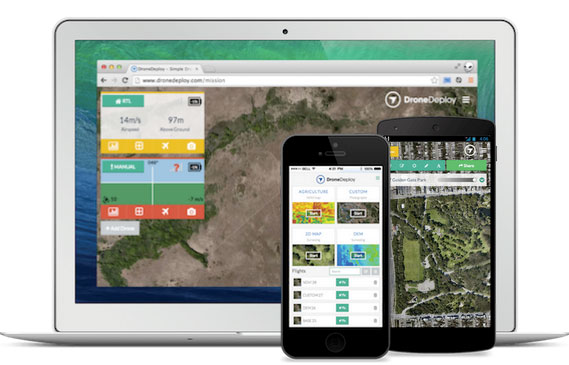
DroneDeploy
Tech Specs: DroneDeploy is software that turns any drone into a mapping machine. With just one click, users can send their drone up to make fast, same-day aerial maps and models of fields. They are stored in the cloud, measurements can be conducted and 3-D models visualized. We have a large suite of NDVI tools for data analysis and yield prediction/estimation.
WOW Factor: Fully-automate the mapping process and store maps in the cloud. The platform enables any farmer to get instant aerial data of their land so they can make fast decisions the same day. With a new suite of tools called the Ag Toolbox, the platform can help predict yields, crop scout and acquire and store accurate data across time.
AgDrone System
Tech Specs: The AgDrone system from HoneyComb is autonomous, rugged, mobile and capable of endured usage under harsh environments. Flight plans can be generated quickly making it feasible to easily plan a mission from a user’s tablet and be flying within minutes of arriving to the field. Missions can be saved to a mobile device to streamline operations and setup time.
WOW Factor: Flies 800 acres in one hour with 2 cameras on board, capturing RGB visible and NIR imagery in high definition The complete system provides everything to plan and fly fields, collect and process data, in-field data viewing, quick map processing and robust mapping tools.
Enduro Drone
Tech Specs: Agribotix delivers agricultural intelligence that increases yields and profits through drone-enabled technologies. We provide the complete system, from drones to the data processing required to produce the results growers can use to boost yields and drop costs.
WOW Factor: We have experience with over 20 different crops in over 20 different countries, making it easy for farmers to benefit from our vast expertise.

![[Technology Corner] Farmers Gain Trust in Autonomy with PTx OutRun Retrofit Kit](https://www.precisionfarmingdealer.com/ext/resources/2026/07/09/Farmers-Gain-Trust-in-Autonomy-with-PTx-OutRun-Retrofit-Kit.webp?height=290&t=1783695127&width=400)

