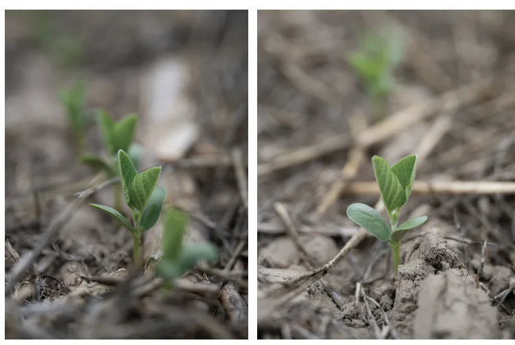
Drones have proven helpful in our cover crop program and beyond. While cover crops have a clear benefit, you’ve got to get them established. We’ve always aerially broadcast seeded cereal rye, wheat or barley cover crops, sometimes with a clover mixed in. Cereal rye is by far the most common. We seed into standing crops in late September, early October in corn and a little later into soybeans. We want to wait until the soybeans start dropping their leaves. When we eventually harvest the crops, there’s this beautiful green mat already growing.
Our issues for establishment are timeliness and field size. We farm a lot of small fields surrounded by trees. Our largest fields are only around 55 acres. Our airplane pilot was very up front. He said he can’t seed the smaller fields effectively. It’s still more efficient to seed the larger fields with an airplane, but for the last 2 years I’ve seeded cover crops in the small fields with drones.
We get much better coverage with the drones, and we can get timely applications, but drone application is time consuming. Until they’re able to cover more acres more quickly, the airplane will remain the logical choice for fields larger than 10 acres or so. I will use them, though, because I want a cover crop on every acre. If that means using drones, that’s what I will do.
Eyes in the Sky
Recently we started working with Taranis for drone applications outside of seeding. The service uses drones with various cameras to effectively scout and record data on our fields. This has proven especially useful as we have many leased fields spread across a wide geography of four counties. It’s just not possible to visit every field consistently.
Taranis came in and offered a package. I like to try new things, but I needed convincing. With the service they would gather data on my fields and fly them at certain strategic times to spot issues. In 2025, I planted corn on a farm 30 miles away from the home place. The drone flew it to conduct a stand count. The application on my phone where I get the data lit up in red showing I had big spots in the field where the corn was dead. It turned out wireworms had taken out a significant portion of the field.
I ended up replanting the field, but what stuck with me was I wouldn’t have known until harvest if not for the drones. I wouldn’t have seen the damage if I had just driven past the field and it was 30 miles away in a direction I don’t have a lot of reason to travel. The drone saved my tail. Replanting that field in time and getting a crop paid for the drone bill for the entire year.
Using this service does create some extra steps. I have a precision ag specialist that works with me full time. Among other tasks, he uploads information to the company so they know what fields we’ve planted, when we planted, etc. They then use temperature and other data to determine when the crop should be up. At that point they fly the fields for stand counts.
A field I recently planted had a stand count of 99%. The field I had to replant had a stand count of 42%, and I learned that from just looking at an app on my phone and seeing numbers that were in the red instead of in the green. Green is good. Red is not.
The drones also scan throughout the season to evaluate weeds, disease, insect pressure, stands and nutrients. You can contract up to six passes per season; it just depends on how much money you want to spend. A lot of people have backed away from drones because margins are so thin, but I didn’t back away because having that stand count saved me big. Last year was a bad year, so the field only yielded 90 to 100-bushel corn, but if I hadn’t replanted there would have been areas that yielded nothing. To me it’s a no-brainer.
For my program I do the stand count and then scan again right before the crop canopies to look for weed pressure. Another pass is made three quarters of the way through the growing season to see if an insecticide or fungicide application might be necessary.
The weed pass has proven useful. I don’t want to spray an entire field if I don’t have to. If the drone shows me that only the back corner of the field is weedy, that’s all I spray. That’s a lot of savings in chemical, wear and tear on your equipment and it saves you time. I also only apply fungicides and insecticides on an as-needed basis. The drones help spot problems. I have also used drones to apply fungicides.
Evening Up
Drones aren’t the first technology we brought to the farm. We have more than 16 years of experience using precision farming techniques.
Our farm was an excellent fit for variable rate technologies. Years of applying biosolids made our pH levels extremely erratic. Spread patterns were uneven resulting in a lot of variability across the fields. It was obvious at harvest. I’d be cutting 40-50-bushel soybeans then I’d hit spots where the yield plummeted. At the time we didn’t have yield monitors, but I could see the problem clearly with my own two eyes.
I would mark the spots and then test them. That’s when we realized pH was a major problem. My dad wasn’t convinced right out of the gate. Shannon’s father was very open to new technologies and encouraged us to try new things. My dad needed proof, which is fair. I did have another ally in my mother. She encouraged me to go ahead with the project and promised she’d write the check herself if it came to it.
With deference to my dad, I started small, grid sampling one 45-acre farm for a variable rate lime application. Using traditional uniform application we would have applied 45 tons of lime. We watched as the spreader worked. At one point, the truck stopped spreading for a long stretch. Dad thought it was malfunctioning. I had the map and knew it was skipping a significant patch where lime wasn’t needed. It did that a lot, which was good news for us.
We ended up applying just 23 tons of lime to the 45-acre field saving us 20-some tons of lime, including the cost of shipping that product. Dad was more than happy with the money we saved and it started to make sense to him. Next, I pushed to put a full lineup of Precision Planting technology on our 12-row John Deere 1760 planter. We have the 20/20 monitors, DeltaForce hydraulic downpressure control and Precision Planting meters . Everything is planted using a prescription, and the monitors and systems help us get excellent seed placement and singulation.
Again, Dad needed proof. Yet again, I brought him around. Just like the lime, he was impressed with how much seed we saved with auto shutoffs and variable rate seeding and fertilizer applications. This technology is particularly useful in our situation. Most of our fields are surrounded by trees. Seeding and fertilizing the same amount right up to the tree edges as you do in the middle of the field is pointless. The trees will use up all the nutrients and out compete the crop. Therefore, we cut back the planting population and the fertilizer rates on the perimeters.
Maps for precision farming applications are created using grid soil sampling conducted ahead of corn crops and past yield monitor data. We look at historic data for trends. If a zone is trending up in production, we might push it a little harder. If a zone leveling off, we might fall back. The same is true of the soil samples. Areas that have been more depleted receive more inputs.
We’re shooting for uniform yields and efficient yields. That doesn’t mean the highest yield, but the yield that provides the most return on investment. Sometimes that means finding products that provide the same result for less cost. For us, this has been the use of biologicals. These products have allowed us to access nutrients already in our soils instead of having to pay out big money to apply synthetic nutrients.


![[Technology Corner] Using Sensors to Measure Impact of ‘Soil Health Management’ Systems](https://www.precisionfarmingdealer.com/ext/resources/2026/07/24/Using-Sensors-to-Measure-Impact-of-Soil-Health-Management-Systems.webp?height=290&t=1784914811&width=400)

