Monitoring and tending crops from the sky is an innovative precision farming technology that can boost yields, cut costs and reduce time spent in the field.
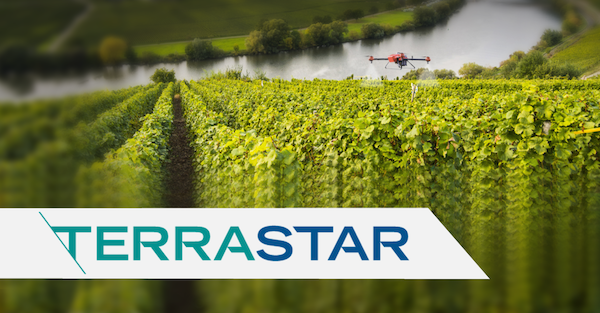
A single flight covering up to hundreds of acres can capture highly accurate images of your fields which means less time spent scouting, and better time spent on resolving specific crop issues. Some growers use drones or Unmanned Aerial Vehicles (UAV) to monitor the health or collect data on their crops.
Others use UAV sprayers that fly over the entire field but only apply crop protectant in the affected areas, significantly reducing the amount of protectant used in their fields. New tools like these provide a positive environmental impact and improve overall operational efficiency and cost.
Precision airborne systems rely on GPS/GNSS technology to determine the exact position and height of the UAV over the field. The precision of an airborne system is determined by the accuracy requirements of your specific application
NovAtel’s TerraStar Correction Service provides the accuracy and reliability farmers need. TerraStar-C is an advanced real-time satellite correction service that provides a high accuracy 5 centimeters (or 2 inches) 95% horizontal position on a NovAtel GNSS receiver that is ideal for accurately identifying areas in the field where crop problems exist and can accurately guide the UAV back to those areas to apply crop protectant.
TerraStar-C eliminates the need for Real-Time-Kinematic (RTK) techniques and RTK networks or local base stations to get high level accuracy. The system also does not suffer the signal losses from obstructions or transmit range that normally occurs using RTK base stations and networks.
TerraStar Correction Service maintains its own worldwide network of reference stations and transmits 24 hours a day, 7 days a week, 365 days a year all-weather correction data over seven satellites, making it possible for your GNSS receiver to see 2 or 3 satellite beams from almost anywhere on Earth for optimum global coverage.
TerraStar provides reliable positioning even in difficult environments and fast re-initialization in challenging conditions. The system is supported on all NovAtel’s OEM7, OEM628, SMART6-L and SPAN on OEM6 products.
Subscriptions can be purchased for various durations and locations. Contact NovAtel or your precision agricultural equipment supplier to find the TerraStar service and subscription that best fits your application needs.
Visit us at Agritechnica in Hall 15 Booth F22 or on www.novatel.com/agriculture. This is part two of a four-part sponsored content series from NovAtel leading up to Agritechnica 2017 in Hannover, Germany.

![[Technology Corner] Using Sensors to Measure Impact of ‘Soil Health Management’ Systems](https://www.precisionfarmingdealer.com/ext/resources/2026/07/24/Using-Sensors-to-Measure-Impact-of-Soil-Health-Management-Systems.webp?height=290&t=1784914811&width=400)

