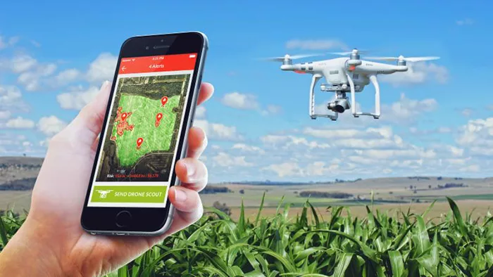
ABOVE: A commercial drone is used as the platform for the MAVRX Drone Assisted Scouting service. Automatic flight plans are loaded and the areas of interest are flown within the field without the need for programming from the operator. The drone automatically launches, sends high-res photos of the areas of interest to the cloud and lands back at base.
Aerial imagery unlocks the potential of using drones. Mavrx leverages its nation-wide UHR aerial imaging network to quickly identify revenue risks. The new drone scout feature then enables drone owners to quickly use Mavrx scouting alerts to autonomously send their camera-equipped drone to the area in the field at risk.
Mavrx CEO Max Bruner is confident that innovations like this are the cornerstones to advancing farm profitability. Mavrx has developed their approach to overcome inefficiencies in locating areas in fields where yield is at risk and eliminate the burden of drone-based image processing. This innovation fulfills the company's vision to save growers time and money while optimizing productivity through novel technologies.
Bruner states, "Our mission is to help farmers get work done efficiently while increasing revenue. This system brings together a number of Mavrx innovations. We're making it possible for experts to remain in a central location to diagnose and direct actions across a large number of fields over a broad area. Time is saved by having scouts drive to the field locations where the drones launch themselves, fly to the areas of interest, and upload geotagged images to their Mavrx account. This allows real-time action to be taken to resolve issues while they can still be addressed" says Bruner. "We want to make field visits as fast and effective as possible."
Bruner explains that the process begins with Mavrx UHR imagery collected by its nation-wide network of piloted airplanes and proprietary imaging pods. This precision imagery is processed and areas of concern are identified automatically. "Target areas identified by Mavrx software are turned into drone flight instructions" notes Bruner. "Once approval is given, the flight plans are sent to the drone. We're providing the drone intelligence so it knows where in the field to go take pictures."
"By removing the hurdles that growers and agronomists face in efficiently scouting in-season and making real-time evidence-based management decisions, we believe this technology will provide great time-saving benefits to commercial agriculture at an affordable price," observes Bruner.
Drone-Assisted Scouting BETA will be available on a limited basis. If interested in learning more, contact Mavrx at 1-844-GO-MAVRX or visit www.MAVRX.co.
Sign up for our Daily Email Update to get articles like this sent directly to your inbox:

![[Technology Corner] Farmers Gain Trust in Autonomy with PTx OutRun Retrofit Kit](https://www.precisionfarmingdealer.com/ext/resources/2026/07/09/Farmers-Gain-Trust-in-Autonomy-with-PTx-OutRun-Retrofit-Kit.webp?height=290&t=1783695127&width=400)

